
Gemini VA
A complete, modern FDV system that helps you manage, document, and understand your entire water and wastewater network.
Designed to support municipalities, utilities, and consultants with accurate data, regulatory compliance, and efficient daily operations.
A full lifecycle system for managing your water and wastewater infrastructure.
Gemini VA is Norway’s leading information system for documentation of the water and wastewater network. Used by around 200 municipalities and utility organisations, it offers a stable and comprehensive platform that supports long‑term data governance.
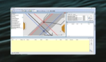
The solution manages complete and topologically correct networks, covering pipes, manholes, hydrants, pumping stations, overflows, tunnels, trenches, ducts, and connection points — all uniquely identified with SID and GUID for reliable lifecycle tracking and seamless data exchanges.
Gemini VA fully supports LAGS and the Ledningsregistreringsforskriften (LRF), including 3D volumetric descriptions, positional accuracy requirements, logging of property changes, and quality‑assured data structures. This helps your organisation delivers work that meets both technical and regulatory expectations.
Specifications
Related products


Common questions about Gemini VA
Find answers here
Yes, Gemini VA fully supports LAGS and Ledningsregistreringsforskriften, including 3D volumetric models, positional accuracy, method classification, and automatic change logging.
It includes powerful import capabilities using GUID matching and spatial proximity, supports SOSI Ledning 4.6, LAGS .gml, Norsk Vann specifications, and allows attachments such as images, measurement data, and aerial photos.
Gemini VA offers thematic maps, statistics (material, age, diameter, etc.), KOSTRA/MATS reporting, and automatic chamber cards, along with data exports to Excel and Shape.
Typical users include municipalities, intermunicipal utilities, consultants, contractors, GIS specialists, planners, and emergency teams managing VA infrastructure.